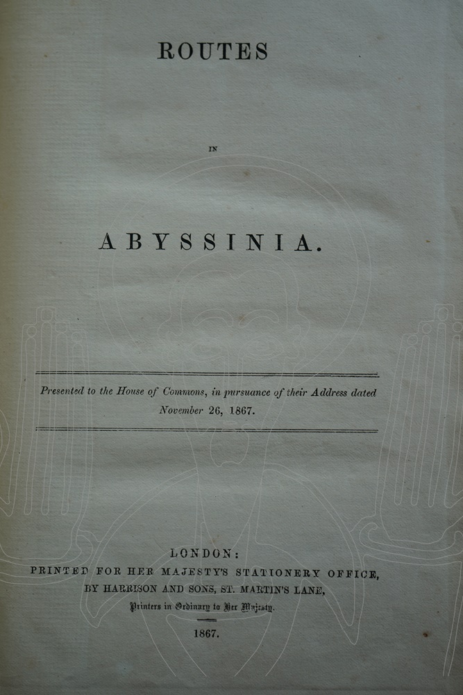
Routes in Abyssinia.
Édition
Éditeur : Harrison and Sons
Lieu : London
Année : 1867
Langue : anglais
Description
État du document : bon
Références
Réf. Biblethiophile : 003010
Réf. UGS : 91030000
Première entrée : 1868
Sortie définitive : 1868
COLLATION :
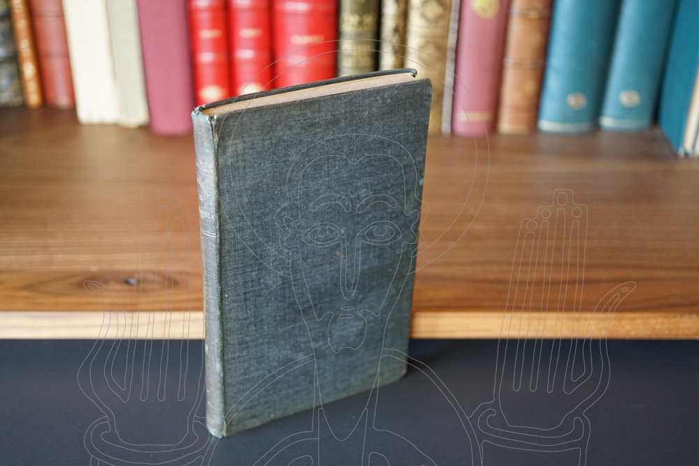
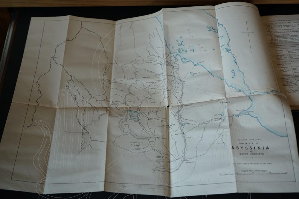
Presented to the House of Commons, in pursuance of their Address dated November 26, 1867. Folding lithographed map, c.36“ x 24”, coloured in outline, at the rear, further folding outline map, professionally repaired. Some light browning, otherwise very good in plain black buckram, a little rubbed. [iv], 252 pp. Printed for Her Majesty’s Stationery Office by Harrison and Sons, 1867.
En savoir plus
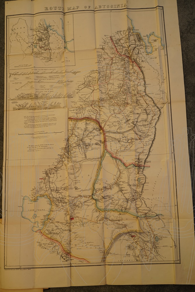
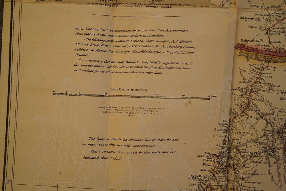
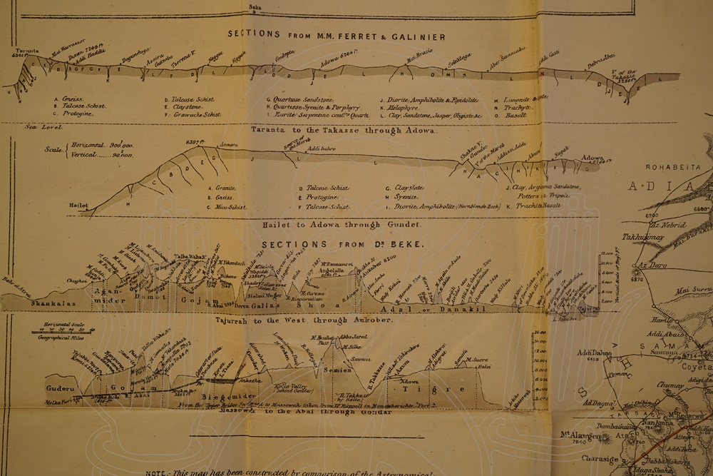
En prévision de l’expédition britannique en Abyssinie, la chambre basse du parlement britannique, la Chambre des Communes, demande au Topographical and Statistical Departement of the War Office de rassembler toutes les informations concernant l’Éthiopie ramenées par les voyageurs. Dans sa préface, le colonel Henry James dévoile la trame de la compilation :
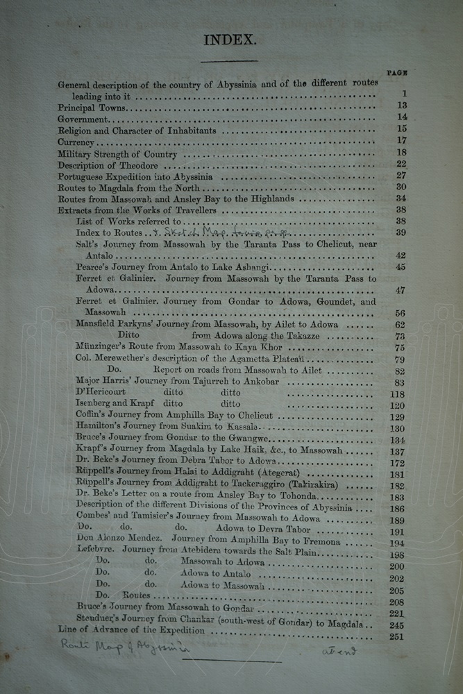
- Description générale du pays et des routes pour entrer en Éthiopie.
- Esquisse sur la nature du gouvernement, de la religion, des habitants, etc.
- Références à l’expédition portugaise de 1541.
- Détail des routes de Massaoua et Annesley Bay à Gondar et Magdala.
- Extraits des ouvrages de différents voyageurs en rapport avec ces routes.
Une carte est dressée en guise de synthèse. Ce travail unique en son genre est l’œuvre du lieutenant-colonel A. C. Cooke. De nos jours, ce travail reste un outil utile et précieux.
Biblethiophile, 08.09.2024
Description du libraire :
“The object of this compilation is to collect together the information on the routes in Abyssinia which is scattered through the works of different travellers…” [From the Preface by Colonel Henry James, Director of the War Office Topographical and Statistical Department.]
Includes extracts from the works of Salt, Bruce and of a more contemporary nature, Dr. Beke and Münzinger, extracted from the Abyssinian Blue Books. The excellent folding map was compiled by E.G. Ravenstein, Geographer at the Topographical Depôt, from the same range of sources and was produced on the Depôt‘s lithographic press under Cooke’s superintendence. Cooke had access to the library and map-room of the Royal Geographical Society in the preparation of this work, and “In return the Topographical Department supplied the RGS with copies of the textual information it compiled and views it reproduced by both lithography and photography.” [Ryan Picturing Empire. p.84] Before entering the War Office Cooke had distinguished himself at the Siege of Sebastopol, directing the right attack, he was later to Command the RE in Bermuda and at Aldershot.
Quite an uncommon item, OCLC lists eight copies with this pagination, but without mentioning the maps. Two further copies are mentioned, of the same date, with maps, but of only 109pp. NSTC further muddies the waters by recording a “Second Edition with Maps”, but without offering a pagination[1].
[1] Maggs & Bros., 2015.